백지

Surveying basics

Surveying basics

WHITEPAPER:
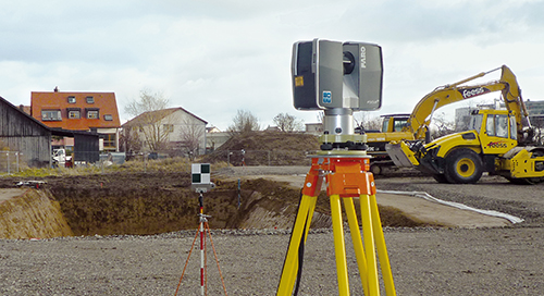
Surveying, as defined by the American Congress on Surveying and Mapping (ACSM), is the science and art of making all essential measurements to determine the relative position of points or physical and cultural details above, on, or beneath the surface of the Earth, and to depict them in a usable form, or to establish the position of points or details.

Through the years, a number of different measurement methods have been used to collect this data. However, as the need for more accurate measurements has evolved, advanced 3D technology has become available to meet existing needs, and provide comprehensive documentation that was not previously possible through traditional methods.
 

백지
건축, 엔지니어링 및 건설
준공 캡처 및 모델링
건축, 엔지니어링, 건설
3D 스캐너
초점
측량 및 측정
인식

뉴스레터를 구독하여 최신 정보를 확인하세요.

관련 콘텐츠

필터

필터

ARTICLE

Public Safety Solutions: Improving Safety with Reality Capture

Transform your team’s public safety work with 3D reality capture. Leverage 3D reality capture and advanced software for forensic analysis, pre-incident planning, and smarter, safer public safety processes.
비디오

Focus Premium Max 및 FARO® SCENE 결합을 통한 스캔

측량사 및 전문 프로젝트를 위한 선도적인 3D 레이저 스캐닝 정합 소프트웨어인 FARO® SCENE에 대해 알아보세요. 대화형 스캔 정합, 하이브리드 정합 및 고급 도구를 갖춘 SCENE은 원활한 geo-rerefencing 적용, 강력한 오류 수정 및 내보내기 유연성을 통해 3D 워크플로를 재정의합니다.
기술 사양서

Orbis Premium 모바일 스캐너의 정확성과 다양한 활용도 경험하기

FARO Orbis™ Premium 모바일 레이저 스캐너는 IP54 내구성, SLAM 스캔 기술, 72MP 이미지, 고밀도 Flash Technology 스캔을 갖춘 강력한 모바일 스캐너입니다.
WEBINAR RECORDING- ROA

Meet the New Focus Premium Max Laser Scanning Solution

Watch this webinar to learn how 3D technologies assist with geospatial, construction, and engineering workflows for enhanced efficiency and better project outcomes.