白書

Surveying basics

Surveying basics

WHITEPAPER:
Surveying, as defined by the American Congress on Surveying and Mapping (ACSM), is the science and art of making all essential measurements to determine the relative position of points or physical and cultural details above, on, or beneath the surface of the Earth, and to depict them in a usable form, or to establish the position of points or details.

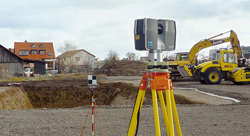
Through the years, a number of different measurement methods have been used to collect this data. However, as the need for more accurate measurements has evolved, advanced 3D technology has become available to meet existing needs, and provide comprehensive documentation that was not previously possible through traditional methods.


白書
建築、エンジニアリング、建設
As-Builtキャプチャとモデリング
建築、エンジニアリング、建設
3Dスキャナー
Focus
測量と測定
認知

ニュースレターを購読して最新情報を入手してください。

関連コンテンツ

フィルタ

フィルタ

ARTICOLO

sicurezza pubblica soluzione: Migliorare la sicurezza con realtà Capture

Trasforma il lavoro di sicurezza pubblica del tuo team con l'acquisizione della realtà 3D. Sfrutta l'acquisizione 3D della realtà e il n/a software per l'analisi forense, la pianificazione pre-incidente e processi di sicurezza pubblica più intelligenti e sicuri.
ARTICLE

What are the benefits of LiDAR in Civil Engineering?

LiDAR in construction enhances infrastructure planning with accurate 3D data, improving design, monitoring, and sustainability for civil engineering projects.
CASE STUDY

Doubling Sales Revenue with Orbis: A Case Study on Hayashi Survey Technical Consultant Inc.

Discover how Hayashi Surveying transformed workforce efficiency and doubled sales revenue with the FARO® Orbis Mobile Scanner.
Article

How 3D Laser Scanning Augments Bridge Inspection

3D laser scanners augment bridge inspection and the data capture process with faster and more mobile LiDAR alternatives.