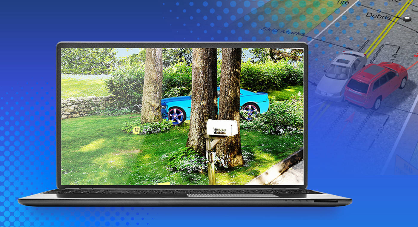
When collecting evidence from a crash scene, investigators, forensic experts, law enforcement experts, and private consultants race against the clock. Continued advancements in reality capture technology have led to fast and accurate methods for determining the physical parameters that lead to a crash. LiDAR (Light Detection and Ranging) is one such innovation used globally for a variety of public safety applications, including accident reconstruction. This article explores the significant benefits of using LiDAR in accident reconstruction, emphasizing its superior accuracy, speed, and efficiency.
What Is Accident Reconstruction?
Accident reconstruction is the process of using advanced tools, like laser scanning technology, to meticulously capture details from crash scenes to document, analyze, and investigate. By capturing precise measurements and a 3D digital model from accident scenes, forensic experts can create a digital picture and the events leading to an incident. These include:
Mapping Terrain
Mapping terrain is a crucial component in accident reconstruction, providing a comprehensive view of the crash site. Understanding the topography helps contextualize the incident, revealing how geographical features may have influenced the crash dynamics. This includes assessing road conditions, identifying obstacles, and examining damage to property beyond the vehicles involved. Accurate terrain mapping ensures that all external factors are considered, leading to a more precise reconstruction of the accident.
Impact Angles
The analysis of impact angles reveals critical details about the collision. By examining the orientation of the vehicles and the concentration of damage, experts can infer the directions and forces at play during the crash. This information is vital for creating accurate models of the incident, which can be used to determine the cause and sequence of events. Understanding impact angles also aids in assessing the behavior of the vehicles and their occupants during the collision.
Vehicle Damage
Capturing the scene promptly after an accident is imperative for documenting vehicle damage accurately. LiDAR technology enables the swift recording of the extent of damage to each vehicle and surrounding property, preserving crucial evidence before any alterations occur. This detailed documentation is essential for legal and insurance purposes, providing an objective and precise account of the damages. Immediate and accurate capture of vehicle damage ensures that all relevant information is available for subsequent analysis and claims processing.
Speed Determination
LiDAR technology plays a significant role in documenting factors that can be used to determine vehicle speeds at the time of the crash. By precisely capturing skid marks, gouge marks, and other surface disturbances, LiDAR provides valuable data for forensic experts. These details help in reconstructing the sequence of events leading up to the collision, offering insights into the speed and behavior of the vehicles. Accurate speed determination is crucial for understanding the dynamics of the accident and for attributing responsibility.
These insights are crucial for understanding accidents in detail, aiding in legal proceedings, insurance claims, and enhancing safety measures to prevent future incidents.
The Advantages of LiDAR Technology
Crash reconstruction is the ultimate detective work, essentially reverse-engineering the elements of a scene to determine the cause of an accident. That includes the physical science and forensics behind the incident. In high-traffic, high-volume locations under what can be punishing natural conditions, quickly collecting and cataloging the scene is critical to safety, preventing evidence loss and mitigating the economic losses of closed roadways.
Today's forensic technology is the key to reconstructing crashes with accuracy. In fact, LiDAR solutions are transforming the law enforcement and private crash reconstruction professions. The technology gathers the evidence quickly and efficiently by creating 3D point clouds of on-scene information that can be uploaded immediately and shared among key stakeholders in the investigative process. But modern day LiDAR solutions come in all shapes and sizes.
Terrestrial Laser Scanning
Terrestrial laser scanning, like that provided by the Focus is a fundamental application of LiDAR technology in accident reconstruction. Mounted on tripods, these scanners capture high-resolution, three-dimensional data of the crash site. This method is particularly effective for detailed, localized surveys, providing precise measurements of distances, angles, and surfaces.
Mobile LiDAR Technology
Mobile LiDAR technology, like that provided by Orbis, offers a versatile and efficient means of quickly capturing data over larger areas. These systems can quickly scan extensive stretches of roadways, capturing detailed information while in motion. This capability is invaluable for reconstructing accidents that involve long skid marks, debris fields, or multiple collision points spread over a distance.
LiDAR Drones
Drones equipped with LiDAR provide high-resolution, aerial views of the crash site, capturing data from angles that ground-based scanners cannot achieve. This aerial perspective is particularly useful for understanding the overall layout of the scene, the distribution of debris, and the relationship between different elements of the accident — although the accuracy of the drone data is not as detailed as that provided by a terrestrial scanner.
Enhanced Evidence Collection
A critical aspect of accident reconstruction is the accurate documentation of the scene and the involved vehicles. Traditional methods such as baseline and total station surveys have their limitations in terms of the number of data points they can collect and the skill required to operate the equipment. In contrast, terrestrial 3D laser scanning generates detailed point clouds, capturing millions of data points at speeds approaching one million points per second. This results in highly comprehensive and precise representations of the accident scene and vehicles, which are crucial for thorough analysis and court admissibility.
Speed and Efficiency in Evidence Collection
Modern laser scanners like the FARO Focus laser scanning solution, which is the only scanner on the market that can scan in Hybrid Reality Capture™ mode, offer a fast and straightforward method for collecting three-dimensional data. Accident reconstruction experts can quickly gather measurements with a single portable device, eliminating the need for additional equipment, cables, or laptops on-site. This efficiency significantly reduces the time spent at the accident scene, minimizing traffic disruptions and enhancing the safety of the investigators while limited distress of the families involved. The rapid data collection capability allows for more detailed and accurate reconstructions in a fraction of the time required by traditional methods.
Versatility
The versatility of 3D laser scanning technology extends to various applications within accident reconstruction. Whether documenting a complex scene or inspecting a damaged vehicle, LiDAR provides detailed point cloud data that can be easily analyzed in FARO Zone 3D Software and shared with other experts. This comprehensive data collection supports multiple purposes, including litigation, fault determination, road and highway safety assessments, and vehicle design evaluations.
Simplified Operation and Reduced Manpower
One of the standout benefits of laser scanning technology — especially with a handheld scanner like the FARO Orbis™ Mobile Laser Scanner — is its ease of use. The setup and operation of a laser scanner are simple enough that vehicle inspections and scene documentation can often be completed by a single person. This not only reduces the manpower required but also allows the operator to focus on other critical aspects of the investigation. The ability to start data collection at the touch of a button and quickly gather comprehensive measurements streamlines the entire accident reconstruction process.
Meeting Rigorous Requirements for Court Admissibility
Data collected using the Focus terrestrial laser scanner meets the rigorous standards required for court admissibility. The accuracy and detail provided by point cloud models ensure that the reconstructions are reliable and can withstand legal scrutiny. This is particularly important in litigation cases where precise and verifiable evidence is crucial for determining liability and fault.
Improving Safety and Reducing Traffic Congestion
By minimizing the amount of time spent on-scene, laser scanning technology enhances the safety of accident reconstruction experts and reduces traffic congestion caused by road closures. Rapid data collection means that roads can be reopened more quickly, reducing the impact on traffic flow and improving overall safety for both investigators and the public.
Integration with Software
LiDAR point cloud data can be integrated into various software solutions to enhance accident reconstruction and analysis. Software solutions like FARO Zone 3D, FARO Connect® Software, FARO SCENE Software, and the Sphere XG Digital Reality Platform provide comprehensive tools for processing, visualizing, and sharing data. FARO Zone 3D Software produces detailed 2D/3D diagrams, animations, and videos, enabling the creation of powerful, shareable deliverables from even a single photograph. For those concerned about security, FARO offers offline data processing through FARO Scene and Connect, ensuring data integrity and privacy. At the same time, FARO's cloud-based solutions like Sphere XG allow real-time data processing and collaboration, enabling teams to start analyzing data while still on-site.
Share Data Faster with Sphere XG
Use Sphere XG for quick data sharing and collaboration. Effortlessly upload data from FARO 3D reality capture devices to Sphere XG, ensuring that all essential parties stay informed, regardless of location.
SCENE Software
SCENE software is designed for processing and managing scan data with advanced features such as real-time on-site registration, automatic object recognition, scan registration, and positioning. This software provides robust tools for accurate and efficient data processing, ensuring that the collected point cloud data is ready for detailed analysis and modeling.
FARO Zone 3D Software
FARO Zone 3D Software is essential for producing courtroom ready visuals like 2D/3D diagrams, animations, and videos.
FARO Connect® Software
FARO Connect software offers robust management of 3D point cloud and image data. Connect serves as an all-in-one desktop solution for local processing of Orbis data. The software also provides optional connectivity to Sphere XG for viewing, sharing, and collaborating on data.
Conclusion
The integration of LiDAR in accident reconstruction provides significant advantages in terms of accuracy, speed, efficiency, and safety. The ability to generate detailed point cloud models, quickly gather comprehensive data, and operate with minimal manpower makes it an invaluable tool for public safety experts. As technology continues to advance, the use of laser scanning in documenting accident scenes and vehicles is expected to become even more widespread, further enhancing the capabilities and effectiveness of accident reconstruction practices.