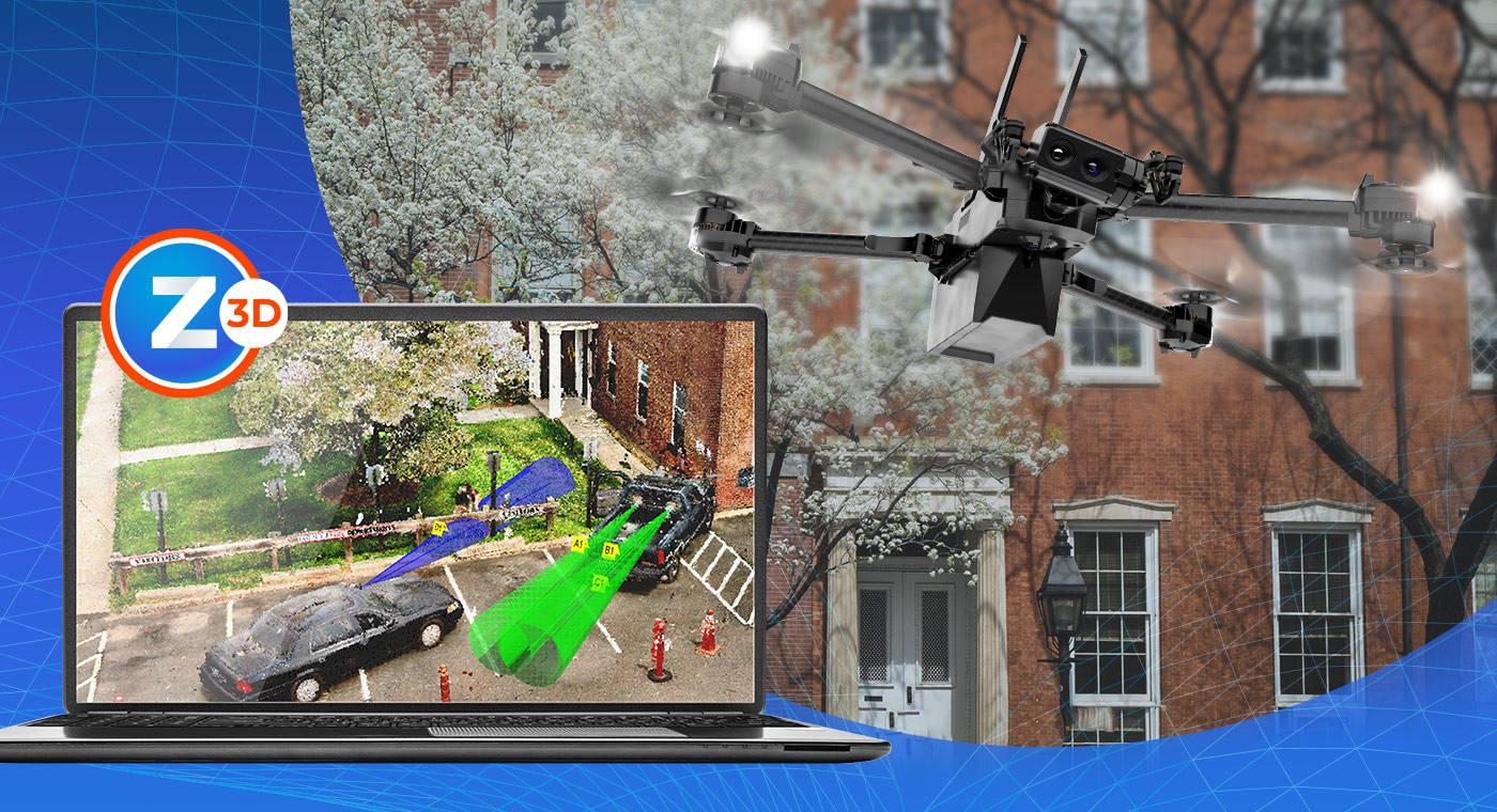
In the realm of crash scene reconstruction, drones have emerged as an essential tool for public safety professionals. Their fast and cost-effective method of capturing crash scenes compliments higher-accuracy, traditional methods of data collection.
Now, imagine the power of pairing the aerial perspective of a drone with the precision of a 3D laser scanner and combining data from both into a comprehensive 2D or 3D diagram?
That's where FARO® Zone 3D Expert Software comes in.
Attend this webinar to:
- Discover a new approach to scene documentation with the use of drone photography in a segment.
- Learn how FARO Zone 3D Expert software supports the import of drone photographs for point cloud creation.
- Understand how to harness point cloud data to create accurate 2D and 3D diagrams tailored for courtroom presentations.
- Learn how this technology is providing innovation for the UK's public safety sector, setting a new standard for scene documentation and analysis.
Presenters:
|
|
Russell Boynton - Senior Field Applications Engineer & Expert in Crash Reconstruction | FARO Technologies Russell Boynton is a Senior Field Applications Engineer and Subject Matter Expert in Crash Reconstruction at FARO Technologies with over 40 years of experience documenting crime and crash scenes. |
|
|
Jeff Voyt - Market Segment Manager for Public Safety Analytics | FARO Technologies Jeff Voyt serves as the Market Segment Manager for Public Safety Analytics at FARO Technologies, Inc. With over two decades of expertise in 3-D capture, imaging equipment, and analysis software, Jeff has dedicated a significant portion of his tenure at FARO to training and assisting public safety agencies and forensic firms in 3-D documentation and analysis of crime and crash scenes. |
Don't miss out on this opportunity to equip yourself with cutting-edge knowledge and expertise. Save your seat!


